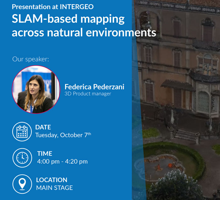
Frankfurt, Germany | October 7 to 9.
Come ogni anno, Stonex parteciperà a INTERGEO 2025, il principale evento internazionale dedicato alle tecnologie geospaziali, che si terrà dal 7 al 9 ottobre 2025 a Francoforte, in Germania.
INTERGEO è la fiera europea più importante per le innovazioni in ambito GNSS, mappatura 3D, GIS, gemelli digitali e altro ancora. Stonex presenterà le sue ultime tecnologie e soluzioni, offrendo ai visitatori la possibilità di scoprire strumenti all’avanguardia e di entrare in contatto con esperti del settore.
Venite a trovarci al nostro stand alla Fiera di Francoforte: diamo forma insieme al futuro dell’innovazione geospaziale!
Hall 12 – Booth 0F081
Demo Area al nostro stand
Scopri la potenza dei dati reali in azione – Casi di studio dal vivo tutti e tre i giorni, dalle 10:00 alle 17:00!
Vieni a esplorare la nostra area demo, dove presenteremo casi di studio concreti e best practice durante l’intero evento!
| Day | Time | Case Study | Field |
|---|---|---|---|
| 7 Oct | 10:00 | From SLAM Scans to 3D Models of Piping and Industrial Assets | Industrial & Facility Management |
| 7 Oct | 11:00 | Combining SLAM Point Clouds in a Landslide Survey | Engineering & Environmental |
| 7 Oct | 11:30 | R180 at a glance and Mont Blanc tunnel case study | Total Station Case Study |
| 7 Oct | 12:00 | Integrated Drone & Handheld SLAM for Heritage Conservation | Architecture & Heritage |
| 7 Oct | 13:00 | Facility Management with SLAM Scanners and Geotags | Industrial & Facility Management |
| 7 Oct | 14:00 | Forestry Analysis from SLAM & UAV LiDAR in the Dolomites | Engineering & Environmental |
| 7 Oct | 15:00 | High-Resolution SLAM for Cultural Heritage in Verona | Architecture & Heritage |
| 7 Oct | 16:00 | Mobile SLAM Mapping of Underground Utility Infrastructure | Industrial & Facility Management |
| 7 Oct | 17:00 | Large-Scale 3D SLAM Survey in a Mountain Canyon | Engineering & Environmental |
| Day | Time | Case Study | Field |
|---|---|---|---|
| 8 Oct | 10:00 | SLAM – Based Powerline Survey for Vegetation Clearance & Inspection | Industrial & Facility Management |
| 8 Oct | 11:00 | Visual SLAM 3D Survey for Historic Pavement | Architecture & Heritage |
| 8 Oct | 12:00 | Large-Scale 3D SLAM Survey in a Mountain Canyon | Engineering & Environmental |
| 8 Oct | 13:00 | From SLAM Scans to 3D Models of Piping and Industrial Assets | Industrial & Facility Management |
| 8 Oct | 14:00 | High-Resolution SLAM for Cultural Heritage in Verona | Architecture & Heritage |
| 8 Oct | 15:00 | Drone LiDAR & Photogrammetry for Glacier Monitoring | Engineering & Environmental |
| 8 Oct | 15:30 | R180 at a glance and Mont Blanc tunnel case study | Total Station Case Study |
| 8 Oct | 16:00 | Facility Management with SLAM Scanners and Geotags | Industrial & Facility Management |
| 8 Oct | 17:00 | Combining SLAM Point Clouds in a Landslide Survey | Engineering & Environmental |
| Day | Time | Case Study | Field |
|---|---|---|---|
| 9 Oct | 10:00 | Mobile SLAM Mapping of Underground Utility Infrastructure | Industrial & Facility Management |
| 9 Oct | 11:00 | Forestry Analysis from SLAM & UAV LiDAR in the Dolomites | Engineering & Environmental |
| 9 Oct | 11:30 | R180 at a glance and Mont Blanc tunnel case study | Total Station Case Study |
| 9 Oct | 12:00 | Visual SLAM 3D Survey for Historic Pavement | Architecture & Heritage |
| 9 Oct | 13:00 | Facility Management with SLAM Scanners and Geotags | Industrial & Facility Management |
| 9 Oct | 14:00 | Integrated Drone & Handheld SLAM for Heritage Conservation | Architecture & Heritage |
| 9 Oct | 15:00 | Combining SLAM Point Clouds in a Landslide Survey | Engineering & Environmental |
| 9 Oct | 16:00 | From SLAM Scans to 3D Models of Piping and Industrial Assets | Industrial & Facility Management |
| 9 Oct | 17:00 | Drone LiDAR & Photogrammetry for Glacier Monitoring | Engineering & Environmental |
Conferenza


