2 Modules to work efficiently
Import point clouds without limitations
For Windows OS
Photogrammetry & 3D data software
2 Modules to work efficiently
Import point clouds without limitations
For Windows OS
On this page:
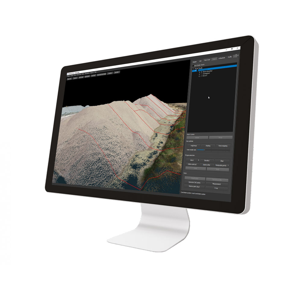
Cube-3d is a complete software for 3D data management, built by two modules for photogrammetry and for scanner data. The former processes images (or videos) to generate accurate digital maps and 3D models with extreme precision; the latter provides tools to align point clouds.
It is compatible with cube-a surveys and with any third-party 3D model. It is possible to draw on point clouds or meshes and merge data imported from traditional survey tools, all in a single software. The data can be then processed and enhanced thanks to the various CAD tools.
Among the many features available, most appreciated are the automatic classification, orthophoto, cross-sections and profile lines, volume calculation, and more. Licenses configuration is very flexible, from perpetual to temporary subscription, it adapts to the needs of many professionals.
Cube-3d is a complete software for 3D data management, built by two modules for photogrammetry and for scanner data. The former processes images (or videos) to generate accurate digital maps and 3D models with extreme precision; the latter provides tools to align point clouds. It is compatible with cube-a surveys and with any third-party 3D model.
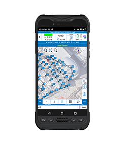
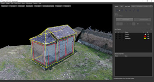
Cube-3d automatically detects both GCPs and detail points, allowing the operator to check the position of the detected targets, in the first step of the orientation.
With Stonex targets, the time needed will be even shorter, centering is immediate. Even working with RTK drones, it will be easy to achieve centimeter accuracy without GCP.
Without selecting a reference system or entering details on the formats used, Cube-3d can receive data directly from Cube-a, with the settings defined in the latter, and use them, for example, as a control point for georeferencing the models.
It is possible to import point clouds from lidar, laser scanners, and without limitation from any tool capable of generating them. The compatibility of this software with all standard formats, used in traditional surveys, will be of great help to professionals.
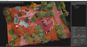
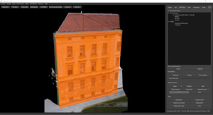
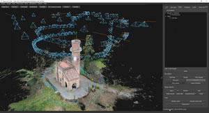
The program can process, in a single project, images captured by any handy camera, UAV drone, or multiple-camera and create extremely accurate and detailed high-definition 3D models. It can generate a fully geo-referenced, spatially orientated, and complete overview of your site configuration.
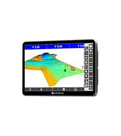
Import clouds from Lidar, Laser Scanners, and without limitation from any tool capable of generating them. Full support for Stonex Scanners and a wide range of import formats. Register point clouds in cube-3d and take advantage of all the excellent tools it provides.
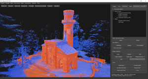
CLASSIFICATION
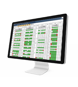
Benefits from an industry-leading classification engine with best-in-class point cloud customization tools that give users fast, easy-to-use, and simple data classification.
ORTHOPHOTO
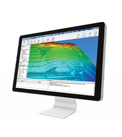
It allows to calculate high-resolution, traditional and true, digital orthophotos with cm-grade precision in perfect geo-referenced details.

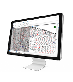
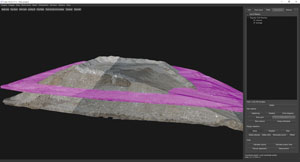
CROSS SECTIONS, PROFILES AND CONTOUR LINES
From point cloud data, it will draw a definition line and calculate single vertical cross-sections or multiple transverse profiles with user-defined intervals.
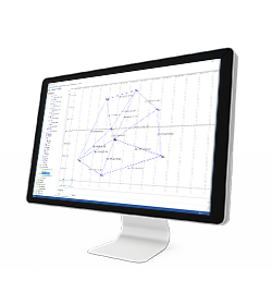
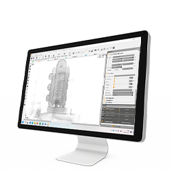
CAD ENGINE
Integrated CAD functions give you the power to work on your project with a complete layer system, snapping tools, drawing options and measurements.
MULTIPLE SURVEY MANAGEMENT
In a single project, process images captured by any handy camera, UAV drone or multiple-camera. Integrate your data with traditional surveys or 3D data coming from other sensors.

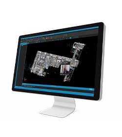
2D VIEWS
From the point cloud, generate 2D views from which you can create sections and draw with CAD tools. Extracting information from the point cloud has never been easier!
REGISTRATION
Use manual registration to join point clouds or meshes, with the possibility of scaling models.
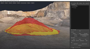
VOLUMES
Calculation of volumes with a single click. Or compare different models for cut & fill estimates, providing a colour map and value report.
MANIPULATION TOOLS
Dedicated tools to move points, increase/decrease height, flatten, and so on. Permit the prediction of future surfaces/results of the areas.
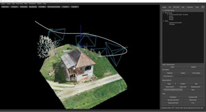
FLYTROUGH
Define a route in your 3D model, which can be navigated by recording a video.
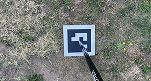
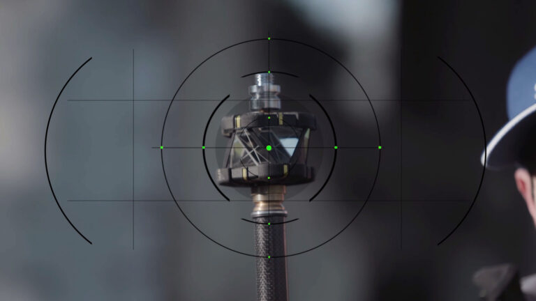
AUTODETECTION TARGETS
Stonex targets guarantee immediate detection. In addition, up to 40 meters AGL, the coded targets allow fully automatic orientation.
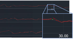
PROFILES
Enjoy the powerful profiles editor. Check the interpolation of the profile over the point cloud and make any changes you like to export a perfect and ready-to-use profile.
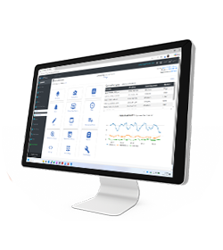
Upload your results to Cube-3d Cloud and access your projects anytime, anywhere.
View point clouds, meshes, orthophotos, and CAD data directly from any device. Simply share a link – your clients can explore detailed views and perform in-depth analyses without installing specialized software. Empower them with tools for precise measurements, annotations, and even comparisons across different project phases.
• Aerial images
• Video
• Images taken by any hand camera
• Total stations & GNSS points
• Region geoid data
• *.dxf data
• Cube-a format (*.cx3d)
• Photogrammetry point cloud
• LIDAR point cloud
• XML surface data
• Orthophoto maps
• Underwater images
• Predefined camera parameters import
• Telemetry data import
• Camera offset support
• Cube-a format (*.cx3d)
• Bathymetry sonar cloud
• Orthophoto (*.Tiff, *.JPG, *.PNG, *KMZ, …)
• Textured 3D model (*.obj, …)
• Point cloud (*.e57, *.las, *.ply, …)
• Digital surface model (*.obj, *.xml)
• Regular/irregular grid mesh
• Contour lines (*.dxf, *.pdf, …)
• CAD drawings (*.dxf)
• Selected points (*.dxf, *.txt, …)
• Quick scketches (*.pdf, *jpg, *.png)
• Survey maps (*dxf, *.pdf, *.jpg, …)
• Camera parameters
• Undistorted images
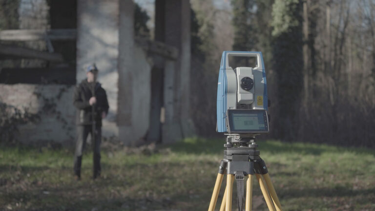
In March 2022 Stonex had the opportunity to carry out a series of surveys inside and outside the “Torretta Viscontea” located in the Monza Park
* Mandatory field