different nodules
powerful field software
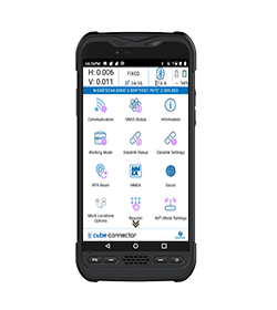
For Android OS
On this page:
![]()
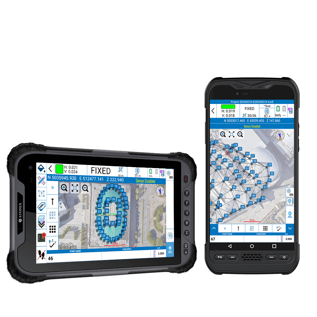
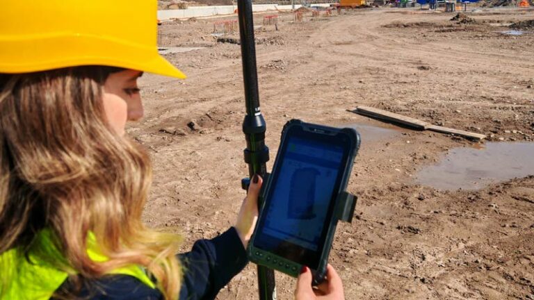
Cube-a is Stonex’s solution for professional surveying and GIS which has been designed and developed for the Android platform. Thanks to the flexibility of the Android environment, we have been able to create a simple and intuitive user interface that makes surveyors ready for any work, saving time and increasing productivity.
Full support for touch gestures and the possibility to install it on Smartphones and Tablets are the keys to the success of Cube-a. It also includes support for many languages and adjusts its interface as from the current system language setting.
Cube-a is a modular application which can be customized as needed: GNSS, Robotic and Classic Total Stations, GIS and 3D Modelling modules can be enabled to fulfill any customer need.
Cube-a is compatible with all Stonex GNSS Receivers.
Supports Rover, Rover Stop&Go, Base and Static modes.
Various screens provide useful information on the status of the GNSS receiver including the position, the Sky Plot, SNR levels and the base position.
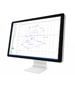
Cube-a has been designed to fully support mixed surveys.
A Cube-a survey supports GPS points and classical polar stations and measures at the same time. Polar stations can be set to occupy previously collected GPS points or on unknown positions calculated using the Free Stationing program.
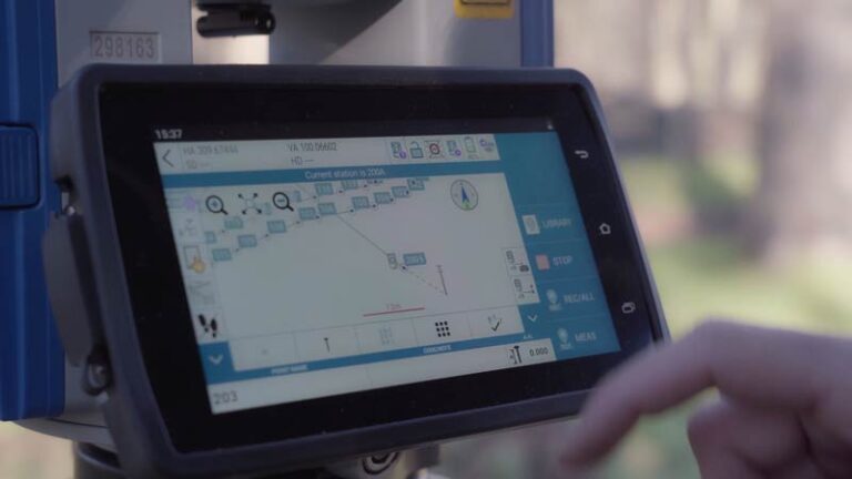
Likewise, the GPS reference system can be adjusted to match an existing polar survey in local coordinates. Cube-a supports all Stonex Total Stations via Bluetooth.
GIS functionalities are well integrated in the workflow of standard GPS surveying. Thanks to the Cube-a’s ability to collect, not only single points but also to automatically draw vectors passing through the collected points, GIS surveying becomes fast and easy.
The request to fill in the GIS data is automatic and automatically follows the point or vector acquisition. Data forms can be freely defined using the integrated Feature Set designer or automatically created by Cube-a starting from a sample DBF file.
Import and export of standard shapefiles ensures the compatibility and interoperability of Cube-a with virtually any other GIS software.
The 3D module adds a complete set of commands for performing real-time surface modeling. Base points and constraints are selected by layer. Optional constraints include a perimeter, break-lines and holes (closed non-triangulated areas).
The surface display mode is selectable from wireframe, filled triangles with edges, shaded triangles with edges or external perimeter with triangulated points. Volume calculations can be easily defined between a model and a horizontal or inclined reference plane. Results, as well as surface data, can be exported to various file formats. Included in this module is the Roads function, which allows the stakeout of the centerlines/base road alignments, and cross sections.
The staking modes available are: by continuous interpolation along the alignment and by station points, elevation can be derived from the elevation profile, the nearest cross section, or by interpolation using previous and next cross sections. The graph proposes two types of views: centerline/alignment and cross section.
Full support for touch gestures and the possibility to install it on Smartphones and Tablets are the keys to the success of Cube-a.
SKY PLOT
Various screens provide useful information on the status of GPS, we also developed the possibility in the Sky Plot to read the presence of Atlas. The innovation to show Atlas correction is in order to help and facilitate the work of surveyors so that, when this correction is needed, they can know if the satellite is seen and in what position.
SURVEY
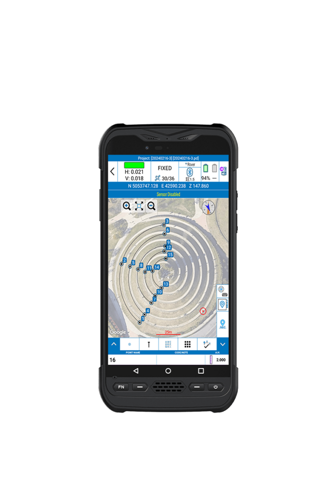
A simple and intuitive survey interface with numerous indicators immediately helps the surveyor to understand what kind of work and in what conditions is taking place. Indicators show various information like solution status, position precision, battery levels, RTK correction delays and more. Intuitive screens allows for an easy change of settings, a view of the collected points, adding new CAD elements and drawings or proceed surveying.
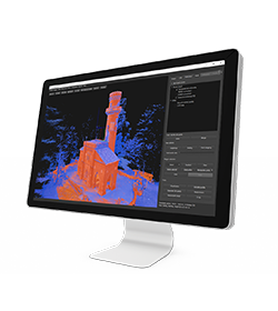
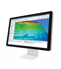
POINT CLOUD AND MESH
Supporting LAS/LAZ, RCS/RCP point clouds, OBJ mesh files, and XYZ files, Cube-a enables precise 3D visualizations from scanned data, efficiently handling large-scale datasets while ensuring near-real-time rendering of point clouds and meshes, providing high levels of detail and accuracy.
Cube-a offers powerful tools for real-time surface modeling, including perimeter selection, break-lines, and volume calculations. Users can choose from multiple display modes, such as wireframe and shaded triangles, and seamlessly export surface data in various formats for further analysis.
STAKEOUT
A compact interface groups all the stakeout launching commands in one screen for an easier work in the field. Stakeout screens are enriched with both graphical and analytical indicators which guide the surveyor in order to reach the target point. Thanks to this interface, you can read all the information necessary to complete the stakeout work, to select points or to add them and quickly change all settings. Even in case of small monitors, the information and commands are always smartly arranged and readable, the buttons are clickable without difficulty and some of them can be reduced to leave more space for the map.
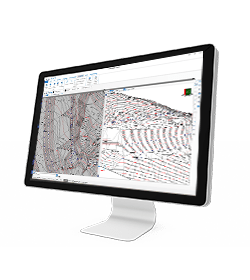
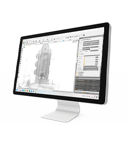
INTEGRATED CAD
Cube-a includes a smart and easy to use CAD feature. The CAD has been designed to work with touch displays and it allows to easily draw points and other CAD entities by mean of a smart pointer which can be moved using one finger and which always transmits to the user a strong confidence of the result achieved. The help of object-snaps like point, mid-point, end-point, intersection and others makes it possible to integrate the survey with new elements directly in the field.
PHOTOGRAMMETRY AND AR
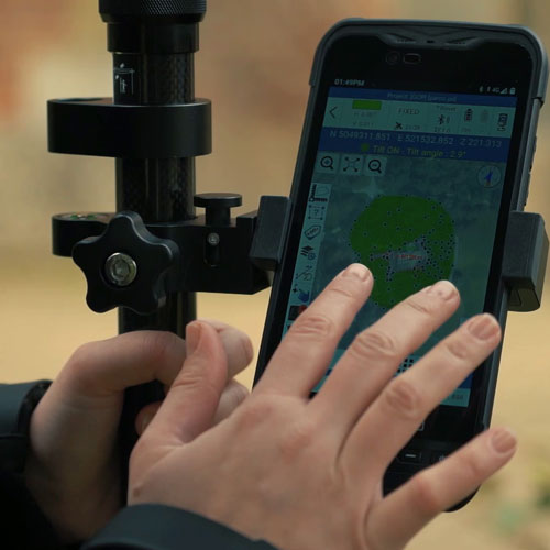
Within Cube-a, the functionalities of the GNSS receivers with cameras can be used. Cube-a simplifies point staking using the cameras of the receiver, the frontal camera which clearly displays the surrounding area to help surveyors accurately identify the point of interest. As the operator approaches, the system automatically switches to the lower camera of the receiver for precise framing, ensuring reliable measurements.
For measuring inaccessible points, Cube-a allows you to record a video of the area you want to measure. The system then extracts several photos that help align the points to be measured, providing calculated coordinates that can be easily recorded.
MIXED SURVEYS
A Cube-a survey supports GPS points and classical polar stations and measures at the same time
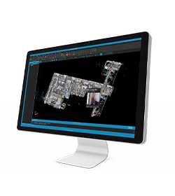
NATIVE DWG AND DXF FORMAT SUPPORT
Cube-a transforms design and surveying workflows with enhanced CAD file interoperability and an intuitive interface. Supporting DWG and DXF formats, it ensures seamless integration with other CAD tools.
PHOTO & SKETCH
To improve and complete the survey and stakeout functions, you can also use the Photo & Sketch. This function can be used while surveying or even on the already acquired points: take photos and add notes, add and position some indicating arrows or simple hand drawn sketches.
• Job management
• Survey Point Library
• System settings (units, precision, parameters, etc.)
• Import/export ASCII and DXF
• Import/export ESRI shapefiles (with attributes)
• Export Google Earth KML/Send to Google Earth
• Import Raster Image
• Share files by cloud services, e-mail, Bluetooth, Wi-Fi
• Customizable ref. systems also by remote RTCM messages
• Features codes (multiple feature tables)
• Fast Coding Panel
• Define GIS features
• Define GIS attributes
• All brand bluetooth disto support
• Support for Stonex receivers
• Generic NMEA (support for third party receivers) – Rover only
• Receiver status (quality, position, sky view, satellites list, base info)
• Full support for features like E-Bubble, Tilt, Atlas, SureFix
• Network connections management
• Support of RTCM 2.x, RTCM 3.x, CMR, CMR+
• Automatic GNSS model & features detection
• Automatic antenna offset management
• Bluetooth and Wi-Fi GNSS connection
• TS Bluetooth
• TS Long Range Bluetooth
• Search and prism tracking (Robotic only)
• Compensator interface
• Station on point
• Free station / Least squares resection
• TS orientation st.dev. and check orientation
• Topographic basic calculation
• Rotate to GPS position3
• Rotate to given point
• Export TS raw data
• Export mixed GPS+TS raw data
• Grid Scan
The solution STX-DIG (2D module) determine the direction/heading using two passive antennas set on the cabin roof. The passive antennas are connected with a dual Antenna GNSS Receiver integrated into the Android Tablet. The tablet provide just the heading when it is used in 2D and stand-alone way (without the use of any correction). Without any correction (Ntrip or Base) the GPS sensors will be use only like a compass heading. In this way it is possible to know the Excavator Rotation with a precision of 0.2°
In 1D or 2D module, when the excavator is moved, the operator use the laser receiver installed on the stick to the laser reference plan when he moves the excavator.
The 2D ½ module use the NTRIP signal to get elevation through the GPS antenna. In this way the operator does not need any Laser Receiver on Excavator Stick and Laser Level.
The main characteristics of the angle sensor are speed, reliability and reduce dimension:
The sensor can be fit on the machine using a weld Bracket Place (included in the solution)
Yes, it is.
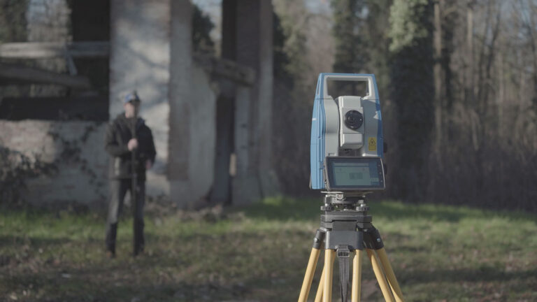
In March 2022 Stonex had the opportunity to carry out a series of surveys inside and outside the “Torretta Viscontea” located in the Monza Park.
STONEX® Srl – 2025 | All rights reserved | VAT/TAXCODE: IT 06830030968 | SHARE CAPITAL € 1.172.400 i.v.
Designed by Isola di Comunicazione
* Mandatory field