The company
Stonex Careers
Certifications
GNSS ReceiversGIS & Mobile GNSSTablets & ControllersRadioSoftware
Total StationsOne Pole SolutionLevels & TheodolitesSoftware
GNSS AntennasCORS GNSS ReceiversSoftware
Monitoring SolutionsTotal StationsGNSSSoftware
SLAM Laser ScannersVisual SLAM ScannersTerrestrial Laser ScannersUAV PayloadsSoftware
FIELDCube-aCube-connector
OFFICECube-3dCube-managerCube-nrtkCube-h24
Earthmoving & ConstructionMarineGNSS & OEMLasersSoftwareCustom Solutions
Agriculture Solutions
3D Scanning
Agriculture & Precision Farming
Architecture & Construction
Bim
Cadastral
Drill & Mining
Earthmoving
Engineering
Forestry
Geology
GIS & Mapping
Heritage & Archaeology
Marine Operations
Mobile Mapping
Monitoring
Public safety
Roads
Solar
Surveying
Utilities
New products
Company news & Press releases
Tradeshows
Trainings & Webinars
Case Studies
Find a dealer
Become a dealer
GNSS SURVEY
OPTICAL SURVEY
GNSS NETWORK
MONITORING
3D SCANNING
CUBE-SUITE SOFTWARE
MACHINE CONTROL
AGRICULTURE
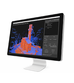
• For Windows OS • 2 Modules • 3D point & digital surface generator
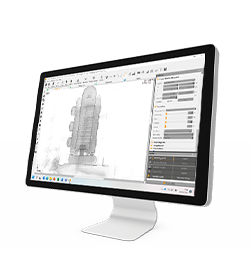
• For Windows OS / macOS • Fast results from point clouds
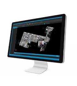
• For Windows OS • Manage 3D data
* Mandatory field