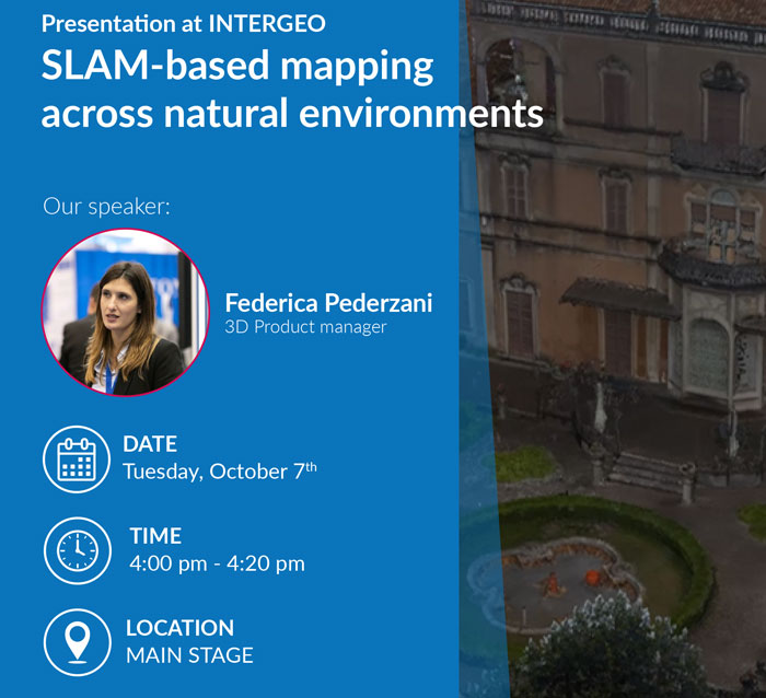
Frankfurt, Germany | October 7 to 9.
As every year, Stonex will be attending INTERGEO 2025, the leading international event for geospatial technologies, taking place from October 7–9, 2025, in Frankfurt, Germany.
INTERGEO is the key platform for innovations in GNSS, 3D mapping, GIS, digital twins, and more. Stonex will showcase its latest technologies and solutions, offering visitors the chance to explore cutting-edge tools and connect with industry experts.
Visit us at our booth in Messe Frankfurt – let’s shape the future of geospatial innovation together!
Hall 12 – Booth 0F081
Demo Area at Our Booth
Experience Real-World Data in Action – Live Case Studies All Three Days, 10 AM – 5 PM!
Come and explore our demo area, where we’ll showcase real-world case studies and best practices throughout the entire event!
| Day | Time | Case Study | Field |
|---|---|---|---|
| 7 Oct | 10:00 | From SLAM Scans to 3D Models of Piping and Industrial Assets | Industrial & Facility Management |
| 7 Oct | 11:00 | Combining SLAM Point Clouds in a Landslide Survey | Engineering & Environmental |
| 7 Oct | 11:30 | R180 at a glance and Mont Blanc tunnel case study | Total Station Case Study |
| 7 Oct | 12:00 | Integrated Drone & Handheld SLAM for Heritage Conservation | Architecture & Heritage |
| 7 Oct | 13:00 | Facility Management with SLAM Scanners and Geotags | Industrial & Facility Management |
| 7 Oct | 14:00 | Forestry Analysis from SLAM & UAV LiDAR in the Dolomites | Engineering & Environmental |
| 7 Oct | 15:00 | High-Resolution SLAM for Cultural Heritage in Verona | Architecture & Heritage |
| 7 Oct | 16:00 | Mobile SLAM Mapping of Underground Utility Infrastructure | Industrial & Facility Management |
| 7 Oct | 17:00 | Large-Scale 3D SLAM Survey in a Mountain Canyon | Engineering & Environmental |
| Day | Time | Case Study | Field |
|---|---|---|---|
| 8 Oct | 10:00 | SLAM – Based Powerline Survey for Vegetation Clearance & Inspection | Industrial & Facility Management |
| 8 Oct | 11:00 | Visual SLAM 3D Survey for Historic Pavement | Architecture & Heritage |
| 8 Oct | 12:00 | Large-Scale 3D SLAM Survey in a Mountain Canyon | Engineering & Environmental |
| 8 Oct | 13:00 | From SLAM Scans to 3D Models of Piping and Industrial Assets | Industrial & Facility Management |
| 8 Oct | 14:00 | High-Resolution SLAM for Cultural Heritage in Verona | Architecture & Heritage |
| 8 Oct | 15:00 | Drone LiDAR & Photogrammetry for Glacier Monitoring | Engineering & Environmental |
| 8 Oct | 15:30 | R180 at a glance and Mont Blanc tunnel case study | Total Station Case Study |
| 8 Oct | 16:00 | Facility Management with SLAM Scanners and Geotags | Industrial & Facility Management |
| 8 Oct | 17:00 | Combining SLAM Point Clouds in a Landslide Survey | Engineering & Environmental |
| Day | Time | Case Study | Field |
|---|---|---|---|
| 9 Oct | 10:00 | Mobile SLAM Mapping of Underground Utility Infrastructure | Industrial & Facility Management |
| 9 Oct | 11:00 | Forestry Analysis from SLAM & UAV LiDAR in the Dolomites | Engineering & Environmental |
| 9 Oct | 11:30 | R180 at a glance and Mont Blanc tunnel case study | Total Station Case Study |
| 9 Oct | 12:00 | Visual SLAM 3D Survey for Historic Pavement | Architecture & Heritage |
| 9 Oct | 13:00 | Facility Management with SLAM Scanners and Geotags | Industrial & Facility Management |
| 9 Oct | 14:00 | Integrated Drone & Handheld SLAM for Heritage Conservation | Architecture & Heritage |
| 9 Oct | 15:00 | Combining SLAM Point Clouds in a Landslide Survey | Engineering & Environmental |
| 9 Oct | 16:00 | From SLAM Scans to 3D Models of Piping and Industrial Assets | Industrial & Facility Management |
| 9 Oct | 17:00 | Drone LiDAR & Photogrammetry for Glacier Monitoring | Engineering & Environmental |
Conference


