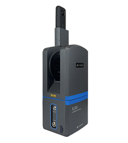
Terrestrial Laser Scanner

High-Precision Terrestrial Laser Scanning for Comprehensive 3D Mapping and Surveying

X100 Laser Scanner

• 360°x268°
• 320.000 pts/s
• External 360° camera support
• Min range 0.5m
• Max range 120m
• Accuracy @10m: 6mm
• Dual Axis Compensator
• 3,2Kg

X100 Laser Scanner

• 360°x268°
• 320.000 pts/s
• External 360° camera support
• Min range 0.5m
• Max range 120m
• Accuracy @10m: 6mm
• Dual Axis Compensator
• 3,2Kg

Send Us a Message

* Mandatory field

Robotic Total Stations

Android OS with Cube-a preinstalled

 for a simple workflow and seamless GNSS integration.

6 models, with accuracies from 0.5″ to 5″

choose the one that best fits your needs.

Prism lock and re-lock system guaranteed in any condition

Reliable tracking even in the presence of obstacles.