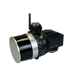
Forest monitoring is crucial in an ever-changing world. Stonex provides different types of instruments to map and monitor forests.
With Stonex tools it is possible to create detailed 3D models on the ground or from a drone and obtain precise mapping of all the necessary elements thanks to the precision of our GNSS.
Multiconstellation GNSS Receivers
Our instruments can work in every environment
Robust and durable equipment
3D Solutions for land and sky monitoring
STONEX Srl – 2025 | All rights reserved | VAT/TAXCODE: IT 06830030968 | SHARE CAPITAL € 1.172.400 i.v.
Designed by Isola di Comunicazione
* Mandatory field
Robotic Total Stations
Android OS with Cube-a preinstalled
for a simple workflow and seamless GNSS integration.
6 models, with accuracies from 0.5″ to 5″
choose the one that best fits your needs.
Prism lock and re-lock system guaranteed in any condition
Reliable tracking even in the presence of obstacles.