A team of professionals was tasked with conducting a detailed survey in an urban area characterized by partially inaccessible points, physical obstacles, and intermittent GNSS coverage. The challenge was twofold: to collect high-precision data and deliver a reliable, navigable 3D model quickly, while avoiding repeated site visits.
To address these issues, the team chose the S999 GNSS receiver paired with Cube-a v.7 software installed on an Android controller. The goal was to achieve maximum detail, precision, and operational speed—even in suboptimal environmental conditions.
Phase 1: Data Acquisition with Video Photogrammetry
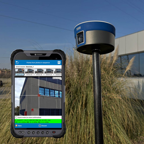
The operator recorded short videos (30–60 seconds) of the most complex areas, keeping the camera perpendicular to the relevant objects and following a smooth, consistent path. CUBE-A’s operational guidelines were followed carefully to minimize errors, avoiding on-the-spot rotations, reflective or moving backgrounds, and maintaining a constant distance from the subject.
The software then automatically extracted key frames from the videos. Using the “Points from Photos in Sequence” feature, the operator was able to select measurement points directly from the images and calculate their coordinates in less than a second per point.
Phase 2: 3D Modeling and Visualization
Once the data collection phase was complete, the entire video set was exported to Cube-3d software, which generated point clouds and 3D meshes of the area—without the need for drones or traditional photogrammetry tools. This allowed for rapid 3D rendering, immediately viewable even on-site.
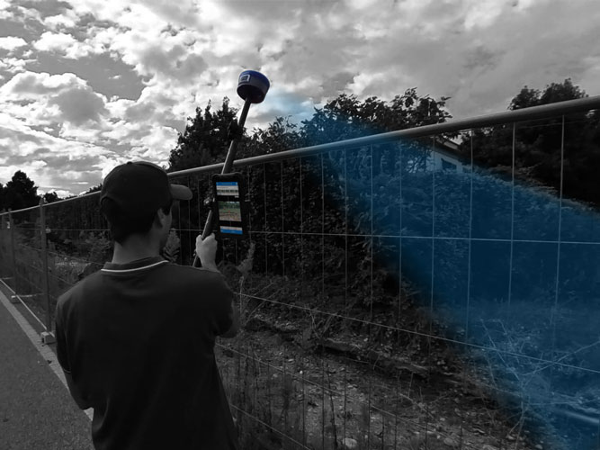
Phase 3: Visual Stakeout
For physically staking out the points, the operator used the Visual Stakeout feature integrated into Cube-a:
The downward-facing camera delivered a live image overlaid with graphic indicators, helping the operator verify whether measurements were within the tolerance range—confirming the ability to proceed with point marking.
The front camera provided an initial overview of the area of interest.
Achieved Results
| Goal | Result |
| Surveying in GNSS-challenged areas | ✓ Successfully completed |
| 3D Modeling | ✓ Generated with Cube-3d |
| Measuring inaccessible points | ✓ Solved via video acquisition |
| Point accuracy | ✓ Better than 1 cm |
| Point processing time | ✓ Less than 1 second |
| Field and office workflow | ✓ Maximum interoperability |
The video-based data acquisition and integrated photogrammetry approach enabled the team to work in GNSS-hostile environments such as historic city centers, enclosed courtyards, indoor spaces, or complex industrial areas. The combined use of the two cameras and the IMU significantly enhanced the efficiency of visual surveying, reduced the margin of error, and accelerated stakeout operations.
The system also proved particularly effective in rapid survey scenarios, where agility is critical without compromising data quality.
Conclusion
This case study demonstrates how the integration of the S999 receiver with Cube-a v.7 software offers an advanced, modern solution for topographic surveying. The combination of GNSS technology, photogrammetry, visual stakeout, and 3D modeling enables operators to work more efficiently, safely, and productively—even in environments that would have once required more complex or compromised solutions.